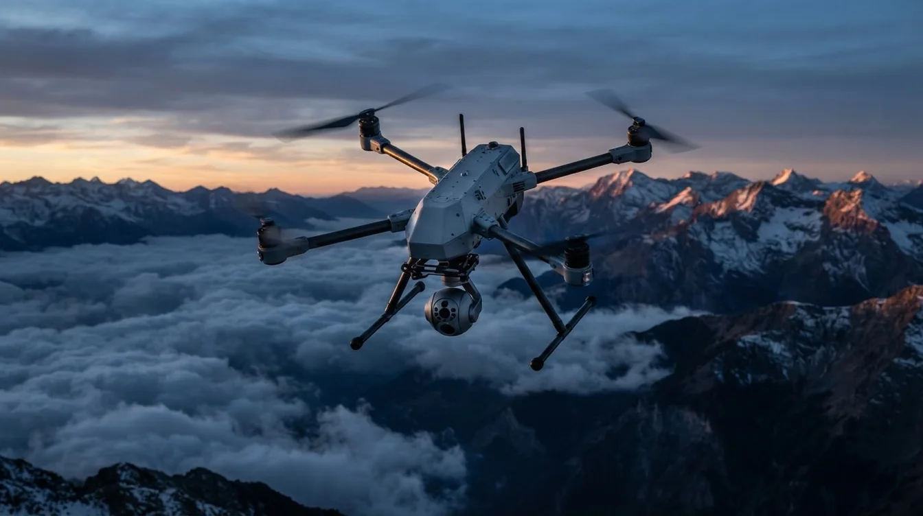
UAV Reconnaissance & ISR: How India's Armed Forces Use Drones
The landscape of modern warfare has undergone a profound transformation, driven significantly by the advent and rapid evolution of Unmanned Aerial Vehicles (UAVs). Once considered niche tools, drones have emerged as indispensable assets for intelligence, surveillance, and reconnaissance (ISR) operations, fundamentally altering how military forces gather information, perceive threats, and execute strategies. From persistent overhead monitoring to precise target acquisition, the capabilities offered by UAV-based reconnaissance and ISR are redefining battlefield awareness and decision-making processes across the globe, including for India's defense sector.
This shift isn't merely about automation; it's about extending human perception into hostile or inaccessible environments with unprecedented endurance, agility, and reduced risk to personnel. The data collected by these unmanned platforms provides commanders with a real-time, comprehensive understanding of the operational environment, enabling more informed and effective actions.
The Evolution of Battlefield Awareness through UAV-based Reconnaissance
Historically, reconnaissance relied on manned aircraft, ground patrols, or even human intelligence, often at significant risk and with limited persistence. The introduction of UAVs has dramatically shifted this paradigm. Early military drones were primarily used for observation, but today's sophisticated platforms integrate advanced sensor packages and artificial intelligence, offering capabilities far beyond simple visual surveillance.
The key advantage of UAVs lies in their ability to operate in "dull, dirty, or dangerous" environments without risking human life. They can maintain continuous patrols over areas of interest for extended periods, providing persistent surveillance that manned aircraft cannot economically or safely achieve. This endurance is critical for tracking elusive targets, monitoring border activities, or assessing battle damage over time. The transition from intermittent snapshots to continuous, real-time data streams has revolutionized how military forces gather and process intelligence, making UAV-based reconnaissance and ISR a cornerstone of contemporary military doctrine.
Key Technologies and Sensor Payloads for Enhanced ISR
The effectiveness of military UAVs in ISR roles is directly proportional to the sophistication of their sensor payloads and data processing capabilities. These drones are not just flying cameras; they are highly integrated intelligence platforms:
- Electro-Optical/Infrared (EO/IR) Sensors: These are standard. EO cameras provide high-resolution visual imagery during the day, often with zoom capabilities to identify targets from a safe distance. IR (thermal) cameras, on the other hand, detect heat signatures, allowing for effective operations at night or through smoke and fog, identifying personnel, vehicles, and even residual heat from recently used equipment. Modern EO/IR systems offer stabilized gimbals for steady footage and advanced image processing for clarity.
- Synthetic Aperture Radar (SAR): Unlike optical sensors, SAR can "see" through clouds, rain, and even light foliage, providing high-resolution ground imagery regardless of weather conditions or time of day. It's particularly useful for mapping terrain, detecting changes over time, and identifying objects obscured by natural cover. Some advanced SAR systems can even detect subtle ground movements, indicating buried objects or tunnel construction.
- LiDAR (Light Detection and Ranging): LiDAR systems use pulsed lasers to create highly accurate 3D models of terrain and structures. This is invaluable for generating detailed digital elevation models (DEMs), identifying camouflage, mapping urban environments, and planning routes for ground forces. For instance, LiDAR can penetrate dense tree canopies to reveal hidden structures or paths below.
- Hyperspectral Imaging: These sensors collect data across a wide spectrum of light, allowing for the identification of specific materials based on their unique spectral signatures. This can be used to detect camouflaged targets, identify types of vegetation, or even pinpoint chemical spills.
- SIGINT (Signals Intelligence) and ELINT (Electronic Intelligence): UAVs equipped with SIGINT/ELINT payloads can detect, intercept, and analyze electronic signals from enemy communications (radio, mobile phones) and radar systems. This provides critical intelligence on enemy locations, capabilities, and intentions, without requiring direct visual contact.
The sheer volume of data generated by these sensors necessitates advanced on-board processing and secure, high-bandwidth data links for real-time transmission. Artificial intelligence and machine learning algorithms are increasingly employed to automatically detect anomalies, classify targets, and flag critical information for human analysts, significantly reducing the cognitive load and accelerating the intelligence cycle.
Tactical and Strategic Applications of UAV-based ISR
The applications of UAV-based reconnaissance and ISR span the entire spectrum of military operations, from tactical engagements to strategic planning:
- Real-time Situational Awareness: UAVs provide commanders with an unparalleled live feed of the battlefield. This includes tracking enemy troop movements, identifying key infrastructure, assessing terrain for maneuver planning, and monitoring target areas before and after engagements. The ability to geo-reference imagery with high precision (often centimeter-level accuracy with RTK/PPK GNSS systems) ensures that intelligence is actionable and reliable.
- Targeting and Strike Coordination: By providing precise coordinates and visual confirmation, drones enable highly accurate targeting for artillery, air strikes, and precision-guided munitions. This significantly reduces collateral damage and increases the effectiveness of military operations. Battle damage assessment (BDA) can also be conducted swiftly, providing immediate feedback on strike effectiveness.
- Border Surveillance and Anti-Insurgency Operations: For nations like India with vast and often challenging border terrains, UAVs offer persistent, cost-effective surveillance solutions. They can monitor remote areas, detect illegal crossings, track insurgent activities, and provide early warning against infiltration attempts. Their ability to operate quietly and at high altitudes makes them ideal for covert observation.
- Search and Rescue/Disaster Response: While primarily a military topic, the dual-use nature of drone technology is evident here. The same aerial survey and mapping capabilities used for military reconnaissance can be rapidly deployed for civilian disaster assessment, locating missing persons, and delivering emergency supplies in inaccessible areas. AiRotor Labs, for instance, leverages similar high-precision mapping and inspection drones for critical civilian infrastructure, demonstrating the foundational technological overlap.
Challenges and Ethical Considerations
Despite their undeniable advantages, the widespread adoption of UAV-based reconnaissance and ISR also presents significant challenges and raises ethical questions:
- Counter-UAV Measures (C-UAS): As drones become more prevalent, so do efforts to neutralize them. Counter-drone technologies include electronic warfare (jamming GPS/control links), cyberattacks (spoofing navigation data), and kinetic solutions (anti-drone guns, nets, or other interceptor drones).
- Data Overload and Analysis: The sheer volume of data collected by multiple UAVs operating simultaneously can overwhelm human analysts. Developing advanced AI for automated analysis and intelligent data fusion is crucial.
- Ethical and Legal Frameworks: The use of armed drones, autonomous targeting systems, and persistent surveillance raises complex ethical and legal questions regarding accountability, privacy, and the rules of engagement. For civilian drone operations in India, the Directorate General of Civil Aviation (DGCA) has established a robust regulatory framework (Drone Rules 2021). These rules mandate unique identification numbers (UINs), remote pilot licenses, and No Permission – No Takeoff (NPNT) compliance, ensuring responsible and accountable drone use in civilian airspace. While military drones operate under a separate, classified framework, the civilian regulations demonstrate India's commitment to managing drone technology responsibly.
The Indian Context: Indigenous Development and Future Outlook
India recognizes the strategic imperative of robust UAV-based reconnaissance and ISR capabilities. The "Make in India" initiative is actively promoting indigenous development of military-grade drones, reducing reliance on foreign imports. The Defence Research and Development Organisation (DRDO) has several projects underway, such as the Tapas BH (formerly Rustom-II), a Medium Altitude Long Endurance (MALE) UAV designed for ISR roles, capable of carrying various sensor payloads.
The unique geographical and geopolitical challenges faced by India—from high-altitude border regions to dense forests and maritime surveillance needs—make advanced drone capabilities critical. The continuous evolution of sensor technology, coupled with advancements in AI and secure communication, promises even more sophisticated ISR capabilities for India's armed forces.
Furthermore, the growth of India's civilian drone industry, exemplified by companies like AiRotor Labs, plays an indirect but vital role. By fostering a skilled workforce, developing cutting-edge sensor integration, and pushing the boundaries of autonomous flight and data analytics for civilian applications like infrastructure inspection, aerial surveys, and land mapping, the civilian sector strengthens the overall national drone ecosystem. This creates a pool of expertise and technological innovation that, while distinct from military operations, contributes to a broader understanding and advancement of drone technology within the country.
Conclusion
The integration of UAVs into military operations has fundamentally reshaped intelligence gathering, surveillance, and reconnaissance. UAV-based reconnaissance and ISR offer an unprecedented level of battlefield awareness, enabling more precise, efficient, and safer operations. As technology continues to advance, these unmanned platforms will only become more sophisticated, playing an even more critical role in defining the future of modern warfare. Their impact underscores the necessity for continuous innovation, both in military and civilian drone applications, to ensure national security and technological leadership.
At AiRotor Labs, while our focus is entirely on civilian applications, we leverage state-of-the-art drone technology for precision aerial surveys, infrastructure inspection, and detailed mapping services across various industries in Ahmedabad and beyond. Our expertise in advanced sensor integration, data analytics, and DGCA-compliant operations positions us at the forefront of drone innovation.
To learn more about our professional drone services or to discuss your specific project needs, visit our website or book a consultation today.
Book Your Drone Service with AiRotor Labs Today!
AiRotor Labs provides drone-based inspection, aerial survey, and land survey across India.
Book a consultation →