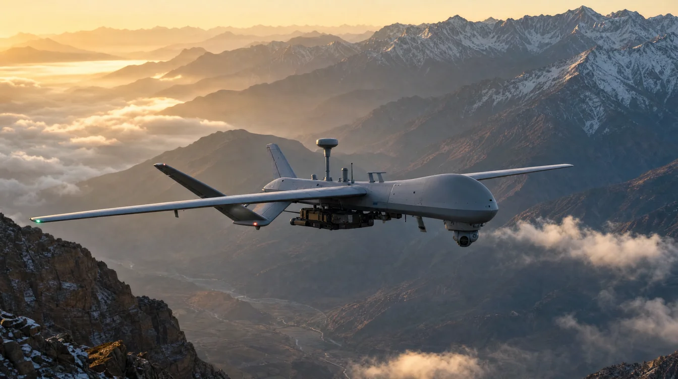
Drone Surveillance for Border Security: Technology and Deployment in India
India's geographical landscape presents a unique set of challenges for border management. With thousands of kilometers of diverse terrain – from the icy peaks of the Himalayas to the arid deserts of Rajasthan, the dense forests of the Northeast, and the marshy Rann of Kutch – securing these vast stretches against infiltration, smuggling, and illegal activities is an immense task. Traditional methods of human patrolling and static surveillance systems, while foundational, often face limitations in reach, endurance, and real-time responsiveness. This is where advanced technologies, particularly drone surveillance for border security, are proving to be transformative, offering an unparalleled aerial perspective and significantly bolstering India's national defense capabilities.
The integration of Unmanned Aerial Vehicles (UAVs) into India's border security framework is no longer a futuristic concept but a vital operational reality. These intelligent eyes in the sky provide continuous monitoring, rapid threat detection, and crucial intelligence gathering, making them indispensable tools for forces like the Border Security Force (BSF), Indian Army, and other paramilitary units. This blog post delves into the core technologies driving this revolution, the strategic deployment considerations specific to India, and the regulatory environment shaping their use.
India's Complex Borders: The Imperative for Advanced Surveillance
India shares land borders with seven countries, each presenting distinct geographical and geopolitical complexities. The Line of Control (LoC) with Pakistan, the Line of Actual Control (LAC) with China, and the porous borders with Nepal, Bhutan, Bangladesh, and Myanmar require constant vigilance. These borders are often characterized by:
- Extreme Terrain: High altitudes, dense jungles, vast deserts, and riverine areas make ground patrols arduous and slow.
- Variable Weather Conditions: From extreme cold and heavy snowfall to monsoon rains and thick fog, visibility can be severely compromised.
- Cross-Border Activities: Persistent threats include terrorist infiltration, arms and narcotics smuggling, cattle rustling, and illegal migration.
- Limited Infrastructure: Many border regions lack developed roads, communication networks, or reliable power, hindering the deployment of traditional surveillance tech.
These factors underscore the critical need for agile, robust, and technologically advanced surveillance solutions. Drones offer a cost-effective and efficient way to cover vast areas, access inaccessible terrain, and maintain a persistent watch, significantly augmenting human efforts and providing an early warning system against potential threats.
Core Technologies Powering Drone Surveillance for Border Security
The effectiveness of drone surveillance hinges on sophisticated hardware and intelligent software working in tandem. For border security applications, drones are equipped with a suite of advanced sensors and processing capabilities:
1. Sensor Payloads: The Eyes and Ears in the Sky
- Electro-Optical (EO) Cameras: High-resolution cameras with powerful optical zoom capabilities (e.g., 30x to 50x optical zoom) allow operators to identify objects and individuals from several kilometers away during daylight hours. These provide clear visual intelligence, crucial for verification and evidence collection.
- Infrared (IR) / Thermal Cameras: Essential for night operations and low-visibility conditions (fog, smoke), thermal sensors detect heat signatures. A typical thermal camera might offer a resolution of 640x512 pixels, capable of detecting a human at distances ranging from 1 to 3 kilometers, depending on environmental conditions and sensor quality. This is invaluable for detecting infiltrators attempting to cross under the cover of darkness.
- Lidar (Light Detection and Ranging): While often used for detailed mapping, Lidar can also be employed in border areas to create precise 3D terrain models. This helps in identifying hidden pathways, tunnels, or changes in topography that might indicate suspicious activity, especially in challenging forested or mountainous regions.
- Radar: Small, lightweight radar units can be integrated into larger drones, providing all-weather detection capabilities. Unlike optical sensors, radar can penetrate fog, rain, and even light foliage, making it highly effective for detecting moving vehicles or groups of people in adverse conditions.
- Hyperspectral/Multispectral Sensors: These advanced sensors can analyze light across many spectral bands, allowing for the detection of camouflaged objects, disturbed earth, or even specific chemical signatures. While more specialized, they offer a significant advantage in identifying hidden threats that blend with the natural environment.
2. AI and Machine Learning Integration
Raw sensor data is overwhelming. AI and ML algorithms are crucial for processing this data in real-time.
- Automated Object Detection and Classification: AI can distinguish between humans, animals, vehicles, and other objects, reducing the cognitive load on operators.
- Anomaly Detection: Algorithms can identify unusual patterns of movement or activity that deviate from the norm, flagging potential threats automatically.
- Predictive Analytics: Over time, AI can learn patterns of infiltration or smuggling, helping predict likely hotspots or times of activity, allowing for proactive deployment.
3. Communication and Data Links
Secure, encrypted, and long-range communication links are paramount. For tactical border surveillance, drones typically utilize robust radio frequency (RF) links, often with frequency hopping capabilities to resist jamming. For operations beyond visual line of sight (BVLOS) over vast distances, satellite communication links become essential, allowing data transmission and control from distant command centers.
4. Navigation and Autonomy
Precision GPS/GNSS systems are standard, often augmented with RTK (Real-Time Kinematic) or PPK (Post-Processed Kinematic) technology for centimeter-level positioning accuracy, vital for precise mapping and target location. Autonomous flight capabilities, including waypoint navigation, automated takeoff/landing, and obstacle avoidance, allow drones to execute complex patrol patterns with minimal human intervention, freeing operators to focus on intelligence analysis.
Deployment Strategies and Operational Considerations in India
The deployment of drone surveillance for border security in India involves tailored strategies based on the specific border sector and threat profile.
1. Types of Drones for Specific Missions
- Fixed-Wing UAVs: Ideal for long-endurance, wide-area patrols over vast stretches of open terrain or coastlines. These can fly for 8-12+ hours, covering hundreds of kilometers in a single sortie, providing persistent overhead surveillance. Their higher speed makes them suitable for rapid deployment to distant areas.
- Multi-Rotor Drones: Best suited for localized, detailed inspection, rapid response to alerts, and operating in complex, confined environments like dense forests or urbanized border areas. With vertical takeoff and landing (VTOL) capabilities, they can hover precisely and deploy quickly. Their flight times typically range from 30-60 minutes, with quick battery swaps for continuous operation.
- Tethered Drones: For persistent, localized surveillance over a fixed point, such as a forward operating base or a specific vulnerable sector. Tethered drones draw power from the ground, allowing for flight durations of many hours, providing a stable, elevated surveillance platform.
2. Integration with Existing Security Infrastructure
Effective drone deployment isn't just about the drones themselves; it's about seamless integration. Data from drones is fed into centralized command and control centers, where it's fused with information from ground sensors (seismic, acoustic), static cameras, radar systems, and human intelligence. This holistic view enables security forces to make informed decisions and deploy rapid response units efficiently. Typical timelines for threat assessment from drone detection to ground response can be as short as 5-10 minutes in critical areas.
3. Overcoming India-Specific Challenges
- Rugged Terrain and Weather: Drones used in India's border regions require robust designs, capable of operating in extreme temperatures, high winds, and heavy precipitation. Specialized models with enhanced dust and water resistance are crucial.
- Logistics and Maintenance: Operating in remote areas necessitates simplified maintenance procedures, readily available spare parts, and trained technical personnel on-site.
- Power Infrastructure: Solar charging stations and portable power solutions are vital for sustaining drone operations in regions with unreliable or non-existent grid power.
- Counter-Drone Measures: As drone use proliferates, so does the threat of adversarial drones. India's border security strategy must also include robust counter-drone systems to detect, track, and neutralize hostile UAVs.
Regulatory Landscape and Future Outlook for Drone Surveillance in India
The Directorate General of Civil Aviation (DGCA) plays a crucial role in regulating drone operations in India. The Drone Rules, 2021, and subsequent amendments provide a comprehensive framework. While these rules primarily govern civilian drone use, they set a precedent for safety, airworthiness, and operational procedures.
- Unique Identification Number (UIN) and Unmanned Aircraft Operator Permit (UAOP): Commercial drone operators typically require these. However, government and defense agencies often operate under specific exemptions or streamlined processes, particularly for security-sensitive missions, provided they adhere to safety protocols.
- "Green Zone" vs. "Red Zone" Flights: The Digital Sky platform delineates permissible flight zones. Border areas are typically "Red Zones" or require explicit permissions, emphasizing the need for close coordination with air traffic control and defense authorities.
- BVLOS Operations: While BVLOS operations are generally restricted for commercial use, they are critical for long-range border surveillance. The DGCA is progressively creating pathways for regulated BVLOS flights, especially for public sector and security applications, recognizing their strategic importance.
The future of drone surveillance for border security in India is promising. We can expect:
- Increased Indigenization: The "Make in India" initiative will likely lead to more domestically manufactured, purpose-built drones tailored to India's specific requirements.
- Swarm Technology: Coordinated drone swarms could patrol larger areas more effectively, sharing data and collaborating on threat detection.
- Enhanced AI Capabilities: More sophisticated AI will enable predictive threat analysis, autonomous decision-making in non-lethal scenarios, and better integration with human operators.
- Advanced Counter-Drone Systems: The development and deployment of robust anti-drone measures will evolve in parallel to mitigate emerging threats.
Conclusion
Drone surveillance for border security represents a paradigm shift in how India protects its frontiers. By leveraging cutting-edge sensor technology, artificial intelligence, and strategic deployment, these unmanned aerial systems provide an invaluable force multiplier, enhancing the situational awareness, response capabilities, and overall effectiveness of India's security forces. As technology continues to advance and regulatory frameworks mature, drones will play an increasingly pivotal role in ensuring the inviolability of India's borders and safeguarding national security.
At AiRotor Labs, we understand the critical role advanced drone technology plays in complex operational environments. While our primary focus is on commercial and industrial applications like infrastructure inspection, aerial surveys, and specialized inspections for solar, wind, and powerline assets, our expertise in high-precision drone deployment, sensor integration, and data analysis provides a strong foundation for understanding the capabilities required for robust surveillance solutions. To learn more about how drone technology can elevate your operational efficiency and security, visit our website.
Contact AiRotor Labs today to discuss your drone service needs: https://www.airotor.in/booking
AiRotor Labs provides drone-based inspection, aerial survey, and land survey across India.
Book a consultation →